With under three weeks to go until departure we really needed to try out the equipment. With our schedule we didn’t have a lot of choices as to when that shakedown campout would happen. So on Friday we left Salt Lake City in a snowstorm that didn’t quit as we went south as we hoped. As a matter of true fact it worsened.
There was some talk of abandoning the trip, but hardheaded as we are, we left the truck at 3:15 in a snowstorm to hike Eagle Canyon to a drop off where you can only continue with ropes. It was 32 degrees. My pack was 39 pounds, Jen’s was 23. We hiked the three miles in two hours. The last half mile or so the wind was howling in the narrow canyon so we started back looking for a side canyon where we might be able to get out of the wind.
With darkness chasing us we finally decided on a spot and hurriedly set up camp and got some supper cooking. With a little difficulty we got the tent up. The stove worked perfectly. By the time we finished eating night was upon us and with night the wind didn’t slow down and the temperature dropped.
It was too cold to look at stars under a sky that was beginning to clear. So we climbed into the tent into the bags. It was 7:20. It was 23 degrees. It was a long, long night. Finally the night faded into dawn but the cold didn’t fade into warm. We crawled out and made coffee. We were too cold for breakfast so we packed up and headed out. It took only an hour to hike back to the truck where we headed for breakfast at Denny’s. It was 11:45 when we pulled into Salina. It was 27 degrees.
What we learned.
1. We can sleep out in below freezing weather.
2. We can carry our packs.
3. Jennifer needs a new plan for gloves.
4. Rodger needs a new plan for upper body clothes.
5. The level ness of the tent is paramount.
6. It is important to set up camp, cook and eat dinner before it gets dark.
7. 2183 is an awful lot of miles.
Pictures:
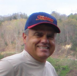
1. The campers.
2. The canyon drop off.
3. The Tent
4. Morning Coffee
There was some talk of abandoning the trip, but hardheaded as we are, we left the truck at 3:15 in a snowstorm to hike Eagle Canyon to a drop off where you can only continue with ropes. It was 32 degrees. My pack was 39 pounds, Jen’s was 23. We hiked the three miles in two hours. The last half mile or so the wind was howling in the narrow canyon so we started back looking for a side canyon where we might be able to get out of the wind.
With darkness chasing us we finally decided on a spot and hurriedly set up camp and got some supper cooking. With a little difficulty we got the tent up. The stove worked perfectly. By the time we finished eating night was upon us and with night the wind didn’t slow down and the temperature dropped.
It was too cold to look at stars under a sky that was beginning to clear. So we climbed into the tent into the bags. It was 7:20. It was 23 degrees. It was a long, long night. Finally the night faded into dawn but the cold didn’t fade into warm. We crawled out and made coffee. We were too cold for breakfast so we packed up and headed out. It took only an hour to hike back to the truck where we headed for breakfast at Denny’s. It was 11:45 when we pulled into Salina. It was 27 degrees.
What we learned.
1. We can sleep out in below freezing weather.
2. We can carry our packs.
3. Jennifer needs a new plan for gloves.
4. Rodger needs a new plan for upper body clothes.
5. The level ness of the tent is paramount.
6. It is important to set up camp, cook and eat dinner before it gets dark.
7. 2183 is an awful lot of miles.
Pictures:
1. The campers.
2. The canyon drop off.
3. The Tent
4. Morning Coffee